The semi-arid climate of Anaheim, with an average annual rainfall of just 13 inches and long dry seasons, creates distinct conditions for subsurface exploration. Exploratory test pits are particularly effective here because the near-surface soils — typically alluvial sands and silts from the Santa Ana River system — remain relatively dry and stable during excavation. Unlike in wetter coastal cities, test pits in Anaheim rarely require dewatering, which keeps the operation straightforward and the visual logging of soil strata highly reliable. Combining this approach with a resistivity survey helps map lateral variability in these alluvial deposits before digging.
In Anaheim's alluvial soils, an exploratory test pit reveals the first 15 feet of stratigraphy with certainty that no borehole can match.
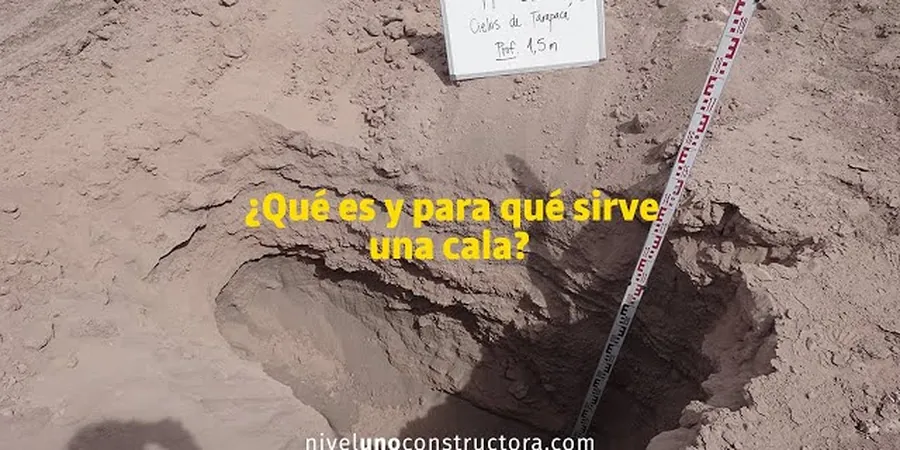
Method and coverage
The local geology around Anaheim features deep alluvial fan deposits from the Santa Ana River and its tributaries, with interbedded gravel, sand, and clay layers extending to depths exceeding 100 feet. An exploratory test pit in this setting typically reaches 10 to 15 feet below grade, providing direct visual access to the upper soil horizons where most shallow foundations and utility trenches are placed. The procedure follows ASTM D2488 for soil description and ASTM D420 for subsurface investigation. Key parameters logged during excavation include:
Stratigraphy thickness and lateral continuity of sand, silt, and gravel layers
Presence of groundwater seepage or perched water tables
Relative density and consistency through pocket penetrometer and torvane tests
Obstructions such as cobbles, buried debris, or old foundations
These observations feed directly into bearing capacity estimates and help classify the site per IBC Chapter 18.
Technical reference image — Anaheim
Regional considerations
Anaheim lies within Seismic Zone 4 per the California Building Code, and the deep alluvial soils can amplify ground motions during an earthquake. A common oversight is assuming a test pit alone provides enough data for seismic site classification — it does not. While the pit shows the soil type and density, it cannot directly measure shear wave velocity (Vs30). For projects requiring Site Class C, D, or E per ASCE 7, the test pit must be paired with a geophysical method like MASW or a borehole-based Vs measurement. The pit data informs the soil classification, but the seismic design parameters depend on wave propagation through the full 100-foot profile.
Bulk disturbed + undisturbed block samples per ASTM D4220
Groundwater observation
24-hour standpipe reading if water encountered
Complementary services
01
Test Pit Excavation and Logging
Backhoe or excavator dug pits logged by a certified geotechnical engineer. Description per ASTM D2488 with photographic record.
02
Undisturbed Block Sampling
Hand-carved block samples from pit walls for lab testing (triaxial, consolidation). Preserved and transported per ASTM D4220.
03
Field Density Testing
Sand cone or nuclear gauge density tests at multiple depth intervals within the pit to verify compaction and relative density.
04
Bulk Sample Collection
Large disturbed samples (30–50 lb) for index tests: sieve analysis, Atterberg limits, and Proctor compaction.
Standards that apply
ASTM D2488-18: Standard Practice for Description and Identification of Soils (Visual-Manual Procedure), ASTM D420-18: Standard Guide for Site Characterization for Engineering Design and Construction Purposes, IBC 2021 Chapter 18: Soils and Foundations — excavation and inspection requirements
Quick answers
How does an exploratory test pit differ from a standard soil boring in Anaheim?
A test pit provides direct visual observation of soil layers in their natural position — you see the stratification, color, and structure firsthand. A borehole gives a continuous profile but only through disturbed cuttings or small-diameter cores. In Anaheim's alluvial soils, test pits are better for identifying buried debris, old foundations, or perched water tables that boreholes might miss.
What is the typical cost range for an exploratory test pit in Anaheim?
For a standard test pit to 15 feet depth including logging, bulk sampling, and field density tests, the cost typically ranges between US$430 and US$770 per pit. This varies with site access conditions, number of pits, and whether shoring is required for safety.
Can a test pit replace a seismic site classification for an Anaheim project?
No — a test pit alone cannot determine the seismic site class (A through F) per ASCE 7. It shows the upper 15 feet of soil, but seismic classification requires the average vs30/" data-interlink="1">shear wave velocity (Vs30) over the top 100 feet. You still need a geophysical survey or a deep boring for that parameter.
Location and service area
We serve projects across Anaheim and surrounding areas.